|
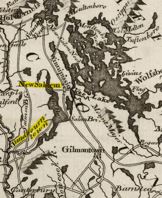
On the 31st of December, 1748, two land grants were made in the vicinity of Lake Winnipesaukee: the "First Township", petitioned by proprietors led by John Sanborn of Hampton, New Hampshire, would become Sanborn's Town (Sanbornton). The "Second Township" was first called "Palmer's Town", after Samuel Palmer, Esq., also of Hampton. This settlement would later be named New Salem, before receiving its current name of Meredith, after being incorporated on 30 Dec, 1768. Over sixty men signed the 1748 petition for this town, the majority of them being from Exeter and Stratham, as well as Hampton and neighboring communities (see the NH State Papers, Vol. 27, pg 478-479 for listing of names). 20 others (to make the required eighty equal shares) were not yet named but included many moving up from Salem, NH [in the Proprietors Recs, pg 12, at a meeting dated 31 Oct 1752, "Salem" was first used as the township's name]. There was one Leavitt named among those original petitioners, JOHN LEAVITT Jr. of Exeter, New Hampshire, a descendant of Moses [Vol. 1, pg 55]. He would be the first man to draw lot numbers on 3 May 1754. Prior to this, the land needed to be surveyed and lot lines drawn up. This was done in 1750 and 1753, by Jonathan Longfellow, surveyor. Each proprietor would first draw a lot number from the first division (100 acres) - John Leavitt received #6 in the 4th Range. They then drew a second number, which provided them with corresponding lots in the 2nd (120-ac) and 3rd (95-ac) Divisions. John picked #37 from that drawing. See: Meredith, 1770 for the lot maps, with each proprietor named (this map differs from the original 1753 one, when lot lines had to be adjusted).  Map of Meredith, 1770 (State Papers, Vol. 27) There were conditions that needed to be met as part of the grant: each proprietor was required to "build a house of eighteen foot long & of fourteen foot wide, or equal thereto". They also needed to clear three acres for tillage or mowing within eight years. A meeting house also needed to be built (on a lot specifically laid out for that purpose) within ten years, and a minister hired to preach the gospel there. The terms and conditions of the 1748 charter were to be met "provided there be no Indian war". Unfortunately, the French & Indian War would soon begin, less than a year having passed since the survey work was done. The settlement would have to be put on hold until the fighting had ended, which did so in 1760 (the official end of the war wasn't until three years later). Proprietor meetings would take place in 1762 and 1764, where voters levied taxes in order to pay for cutting a road to the new settlement, and to begin work on the saw mill there [NH Gazette, 11 Apr 1766]. By this time, some of the land "owners", having defaulted on their agreed terms, would lose their lots. Those lands were now granted to new settlers. By 16 June, 1768, seventeen families had settled in New Salem and became residents, with four more on their way. A petition was filed on this date, to incorporate the town. The inhabitants were granted this, and the settlement became known as Meredith on 30 Dec, 1768 [NHSP: Vol. 12, 582]. John Leavitt Jr. never made the move to Meredith, instead remaining in his native Exeter, NH. In the State Papers [Vol. 27, pg 489-491] there is a list comprised of all those first division lots where improvements had been made by 1770, with Mr. Leavitt not among them. Being delinquent in his taxes for his three lots, he began to sell them off. 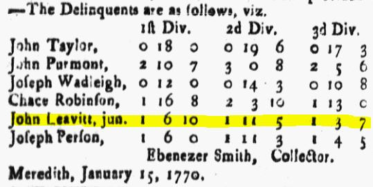 from the NH Gazette, 9 Feb 1770, pg 4 John first sold an acre piece from his First Division lot, which bordered the center square of town, with the intended purpose of the town to use as a burying ground and meeting house. A town vote in April 1774 approved the building of a 40 ft. by 32 ft. structure there [Hist. of Merr. and Belk. Counties, pg 836]. The remaining 99 acres was sold in 1776 to John Gilman [Strafford County Deed, 7-361]. James McCrillis purchased [Strafford Cty Deed 22-409] the 90-acre lot in the 3rd Div, 1778, while Daniel Smith bought #37 in the 2nd Div. in 1799 [Strafford Cty Deed 41-288].
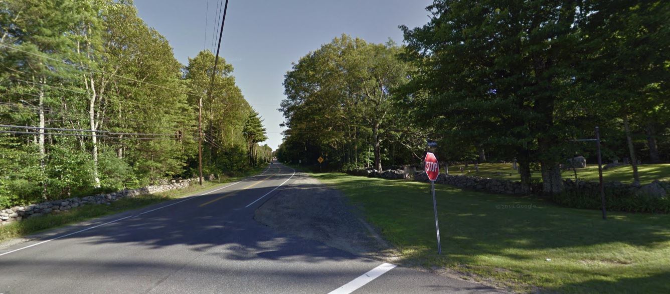 From the 2013 Google Street View, this image shows the Parade Rd (Rt 106) in Laconia, looking south. The "old pound" is on the left, next to telephone pole, while the old town burying ground, now called Blaisdell Cemetery, is on the right. John Leavitt's lot would have included everything seen to the right. The GPS co-ords for this location are: 43.596340, -71.496652
0 Comments
Leave a Reply. |
NALF NotesUpdates about our Leavitt genealogy research, our DNA projects, and other notes to keep our membership informed. Archives
September 2023
Categories
All
|
 RSS Feed